


GS3 – Disaster Management
A flood is the overflow of water onto normally dry land, typically due to excessive rainfall, river overflow, dam breakage, or storm surges. Floods are among the most frequent and damaging natural disasters.
Types of Floods
| Type | Description |
| Riverine Floods | Caused by the overflow of rivers during intense rainfall or snowmelt (e.g., Brahmaputra floods). |
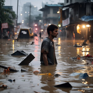
| Urban Floods | Occur in cities due to inadequate drainage systems during heavy rains (e.g., Mumbai floods). |
| Flash Floods | Sudden and intense flooding caused by short bursts of rainfall, often in hilly areas. |
| Coastal Floods | Result from storm surges during cyclones or tsunamis (e.g., Odisha, Tamil Nadu). |
| Pluvial Floods | Flooding due to excessive rainfall not absorbed by the ground, even without nearby water bodies. |
| Glacial Lake Outburst Floods (GLOFs) | Caused by the sudden release of water from a glacial lake (e.g., Chamoli, Uttarakhand). |
Major Causes of Floods in India
Natural Causes
- Heavy Monsoon Rainfall
- Snowmelt in Himalayan Rivers
- Cyclones & Storm Surges
- Topography & River Siltation
- Climate Change & Extreme Weather Events
Anthropogenic Causes
- Encroachment of floodplains
- Deforestation & soil erosion
- Unplanned urbanization
- Poor drainage systems
- Dam mismanagement (sudden water release)
Flood-Prone Regions in India
| Region | Rivers Involved / Cause |
| Assam & NE States | Brahmaputra, Barak |
| Bihar & UP | Ganga, Kosi, Ghaghara |
| West Bengal | Damodar, Ganga |
| Odisha & AP | Cyclonic storms & river overflows |
| Kerala & Karnataka (Western Ghats) | Heavy rainfall, flash floods |
| Urban areas | Mumbai, Delhi, Chennai, Bengaluru |
Impacts of Floods
Social:
- Loss of life & displacement
- Water-borne diseases
- Destruction of homes, schools, hospitals
Economic:
- Damage to crops, infrastructure, transport
- Disruption of livelihoods
- Financial burden on relief & rehabilitation
Environmental:
- Erosion & land degradation
- Siltation of rivers
- Destruction of ecosystems and habitats
Flood Management in India
Structural Measures
- Dams, reservoirs & embankments
- Drainage channels
- Flood zoning and watershed management
- Urban stormwater drains
Non-Structural Measures
- Flood forecasting & early warning systems (e.g., IMD, CWC)
- Disaster response & evacuation plans
- Awareness campaigns and mock drills
- Remote sensing and GIS for flood mapping
- National Disaster Management Authority (NDMA) Guidelines
Institutional Mechanisms
| Institution/Plan | Role |
| NDMA (2005) | Lays out guidelines on flood preparedness & mitigation |
| CWC (Central Water Commission) | Monitors rivers and provides flood forecasts |
| State Disaster Management Authorities (SDMAs) | Local flood response |
| IMD & ISRO | Weather forecasts & satellite-based flood mapping |
| NCRMP | National Cyclone Risk Mitigation Project (for coastal flooding) |
Recent Initiatives & Best Practices
- Flood Early Warning System (FEWS) – Used in Mumbai, Chennai, Guwahati
- Mukhya Mantri Jal Swavlamban Abhiyan (Rajasthan) – Watershed management
- National Hydrology Project – Real-time data for flood risk mapping
- Room for the River Project (Netherlands) – International best practice for floodplain restoration