


GS3 – Agriculture
Context
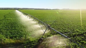
The Ministry of Agriculture & Farmers’ Welfare is actively using space-based technologies like FASAL, YESTECH, and Krishi-DSS for improving agricultural planning and implementation.
(Source: PIB)
Key Applications of Space Technology
- Crop Estimation:
- FASAL uses satellite and remote sensing data to estimate sown area and crop yield.
- Drought Monitoring:
- ISRO’s Drought Geoportal tracks rainfall, temperature, and soil moisture through real-time remote sensing.
- Smart Sampling for Insurance:
- Remote sensing improves sampling under PMFBY’s Crop Cutting Experiments (CCEs).
- Agricultural Decision Support:
- Krishi-DSS (2023) integrates weather, soil, and satellite imagery for localised agri-advisories.
- Yield Forecasting:
- Tools like UAVs, simulation models, and AI/ML help forecast yields at the panchayat level.
- Insurance Claim Settlement:
- YESTECH (2023) uses geo-tagged yield data to ensure transparent and timely claims.
Significance for Indian Agriculture
- Efficient Input Use: Enables precise application of water, fertilisers, and pesticides.
- Enhanced Productivity: Detects crop stress early, improving crop health and yields.
- Disaster Risk Reduction: Provides early warnings for droughts, floods, and pest outbreaks.
- Market Stability: Better forecasting aids in procurement, logistics, and price regulation.
- Farmer Inclusion: Delivers real-time, localised guidance to small and marginal farmers.