


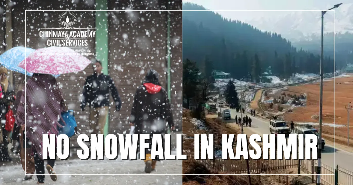
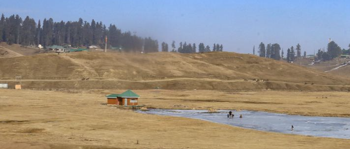
January is usually the month when Kashmir and Himachal Pradesh are covered in snow. This winter, however, these areas have been extremely dry. Places like Gulmarg and Pahalgam, which are well-known skiing destinations, have been unable to provide opportunities for the winter sport. Himachal Pradesh, a state known for its mountain resorts, has seen dry slopes and valleys of brown grass. The Himalayan ranges of Uttarakhand have also reported minimal snowfall, with the first bout of snow in January at Auli, a popular hill resort, occurring on January 19. According to records from the India Meteorological Department (IMD), Himachal Pradesh experienced its driest January since 1901, with a 99.7% decrease in January rain compared to normal. Until this year, the record for the driest January was 1996, which reported a 99.6% shortfall.
The explanation for the lack of snow:
Snowfall requires adequate moisture as well as atmospheric temperatures of zero degrees or lower. Temperatures have been fairly low since December. According to an IMD analysis released in mid-January, maximum temperatures in the plains of north India have been 5-8°C ‘below normal’ since December 29. For the majority of January, minimum temperatures remained below 4 degrees Celsius at many stations in northwest India. This also resulted in a dense fog over the plains of northwest India. Several cities in the region reported zero visibility across the entire north-Indian plains from Amritsar to Dibrugarh, spanning Haryana, Delhi, Uttar Pradesh and Bihar. While moisture and high aerosol loads contribute to fog, there were three major reasons for the lack of snowfall, which resulted in intensifying cold waves across northern India. These included a significant decrease in Western Disturbances (WDs) over northwest India, prevailing El Niño conditions, and the lack of a strong jet stream.
Three factors influence snowfall:
Western disturbances are storms that form in the mid-latitudes and travel thousands of kilometres to bring rain to northern India. In the winter, such WDs dissipate fog and increase the amount of sunlight that hits the ground, raising temperatures. When temperatures are low, they cause snowfall and make water available as snow melts. The melting glaciers add to the water supply in the Ganga, Indus, and Yamuna. On the other hand, they can bring hail, which is devastating to standing wheat crops. Typically, 5-7 WDs affect northwest India from December to January. This winter, however, there have been none. There were two WDs during this time, but their impact was primarily limited to Gujarat, north Maharashtra, east Rajasthan, and Madhya Pradesh. Due to the lack of these rains, the Western Himalayan Region received 80% less rain than usual.
El Niño conditions in the equatorial Pacific Ocean, as well as warmer ocean temperatures, may have played a role. However, regardless of El Niño or La Nina, the number of WDs in December and January has been declining. India experienced its hottest December on record during the winter of 2022-23 (December and January). The northwest region, which typically reports nearly one-third of its rainfall during this season, experienced an 83% rainfall deficit.
In recent years, there has been an increase in these WDs in February and March, resulting in flash flooding, particularly in Uttarakhand and Himachal Pradesh. Last year, for example, there was record-breaking rainfall in February. In general, the traditional pattern of WDs has been disrupted since 2019, when we last saw a conventional WD pattern. As several meteorologists and climate scientists have noted in recent years, extended dry spells and intense wet spells are typical of global warming.
What part do Jetstream have?
Jet streams are powerful winds that travel at approximately 12 kilometres above mean sea level at speeds ranging from 250 to 320 kilometres per hour. They are carriers of western disturbances, but due to a lack of moisture, they have contributed to the subsidence of cold air, enhancing the cold over north India. Jet streams that form after the monsoon has passed can also draw moisture from the Arabian Sea. In recent years, the jet stream has been moving northward. This, according to emerging research, is the result of warming in the Arctic seas, which affects the natural temperature gradient required to maintain the strength and direction of jet streams.