


Context:
The water levels of Yamuna hit a 60-year-high and waters advanced towards the Taj Mahal for the first time in half a century.
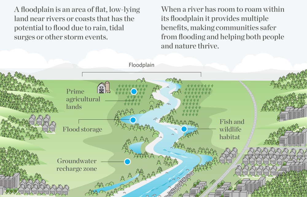
What is a floodplain?
About the River and its significance:
The Yamuna is the second-largest tributary of the Ganges by discharge and the longest tributary in India.
- It originates in the Yamunotri Glacier on the southwestern slopes of Bandarpunch peaks of the Lower Himalaya in Uttarakhand.
- It merges with the Ganges at Triveni Sangam, Allahabad.
- This is a site of the Kumbh Mela, a Hindu festival held every 12 years.
- Yamuna is a lifeline to five States, and its floodplains are a charging point.
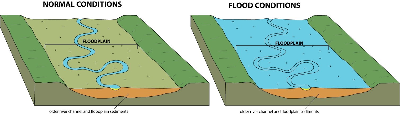
- As part of river systems, floodplains slow water runoff during floods, recharge groundwater and store excess water, replenishing the city’s water supply.
- When you have sluggish flow, the surplus water stored in the floodplain is released back during the non-monsoon season.
- Delhi recorded similarly devastating floods in 1978, 1988 and 1995 which inundated floodplains, adversely impacting their health.
Settlements on these floodplains:
- The first major non-agriculture settlements appeared after Independence when refugees from Western Punjab fled to Delhi.
- The planning era propelled urbanisation in the 1950s and ‘60s, witnessing the construction of the first thermal power plant (employing people as labourers to unload coal from trains and clear fly ash), the Ring Road and Rajghat Samadhi.
- The 1982 Asian Games brought more than one million migrant labourers from neighbouring States.
- Workers eventually settled on the open plain along the western embankment after the Games.
- The population boom outpaced Delhi’s ability to build a proper sewage network and spiked Yamuna’s pollution.
- The Delhi High Court in 2004 ordered eviction of “unauthorised” settlements on the floodplains, demolishing shanties and evicting more than two lakh people.
Impact of encroachments:
- If there is building activity on areas reserved for recharge, groundwater is lost.
- The layers of sediments of floodplains create aquifers contributing to the river channel, which in turn rejuvenates the groundwater.
- But encroachments stop this two-way exchange.
- The river is unable to transport flood waters downstream during monsoons, wet the lands or deposit soil along its banks to preserve the riverine ecosystem.
- Floodplains also protect against devastating flash floods by allowing excess water to spread out and storing that surplus.
- However, encroachments restrict the river to a small channel.
- Any intense rainfall activity (India received 26% more rainfall in July than expected) swells the river, expanding in height not in width, eventually spilling over with devastating intensity.
- Climate change has intensified rains in frequency and severity, and seen in the Yamuna floods, runoff water comes as a huge gushing flow in a small span of time.
Way forward:
The Yamuna rejuvenation should follow the total no-go logic for the floodplains. All proposed projects should also be rapidly re-examined. Freeing the floodplains can ride the appetite for bold urban shifts towards sustainability and lifestyles that are pro-environment.
SOURCE: THE HINDU, THE ECONOMIC TIMES, PIB